
Canterbury Plains and The Southern Alps. | Christchurch, New zealand, Alps
Southern Alps / Kā Tiritiri o te Moana
The range includes the South Island's Main Divide, which separates the water catchments of the more heavily populated eastern side of the island from those on the west coast.
Politically, the Main Divide forms the boundary between the Marlborough, Canterbury and Otago regions to the southeast and the Tasman and West Coast regions to the northwest.

Southern Alps / Kā Tiritiri o te Moana
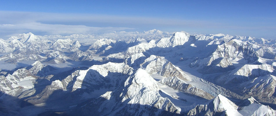
Snow highlights the mountain range in this satellite image
Peak : Aoraki / Mount Cook
Elevation : 3,724 m (12,218 ft)
Length : 500 km (310 mi)
Names
The Māori name of the range is Kā Tiritiri o te Moana, meaning "the Mirage of the Ocean".
The English explorer James Cook bestowed the name Southern Alps on 23 March 1770, admiring their "prodigious height".
They had previously been noted by Abel Tasman in 1642, whose description of the South Island's west coast is often translated as "a land uplifted high".
Following the passage of the Ngāi Tahu Claims Settlement Act 1998, the official name of the range was updated to Southern Alps / Kā Tiritiri o te Moana.
Geography
The Southern Alps run approximately 500 km northeast to southwest. Its tallest peak is Aoraki / Mount Cook, the highest point in New Zealand at 3,724 metres (12,218 ft).
The Southern Alps include sixteen other points that exceed 3,000 metres (9,800 ft) in height (see NZ Mountains by Height). The mountain ranges are bisected by glacial valleys, many of which are infilled with glacial lakes on the eastern side including Lake Coleridge in the north to Lake Wakatipu in Otago in the south. According to an inventory conducted in the late 1970s, the Southern Alps contained over 3,000 glaciers larger than one hectare, the longest of which – the Tasman Glacier – is 23.5 kilometres (14.6 mi) in length which has retreated from a recent maximum of 29 kilometres (18 mi) in the 1960s.
Settlements include Maruia Springs, a spa near Lewis Pass, the town of Arthur's Pass, and Mount Cook Village.
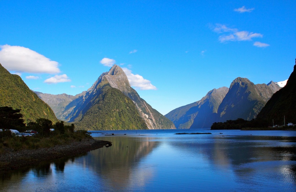
Major crossings of the Southern Alps in the New Zealand road network include Lewis Pass (SH 7), Arthur's Pass (SH 73), Haast Pass (SH 6), and the road to Milford Sound (SH 94).

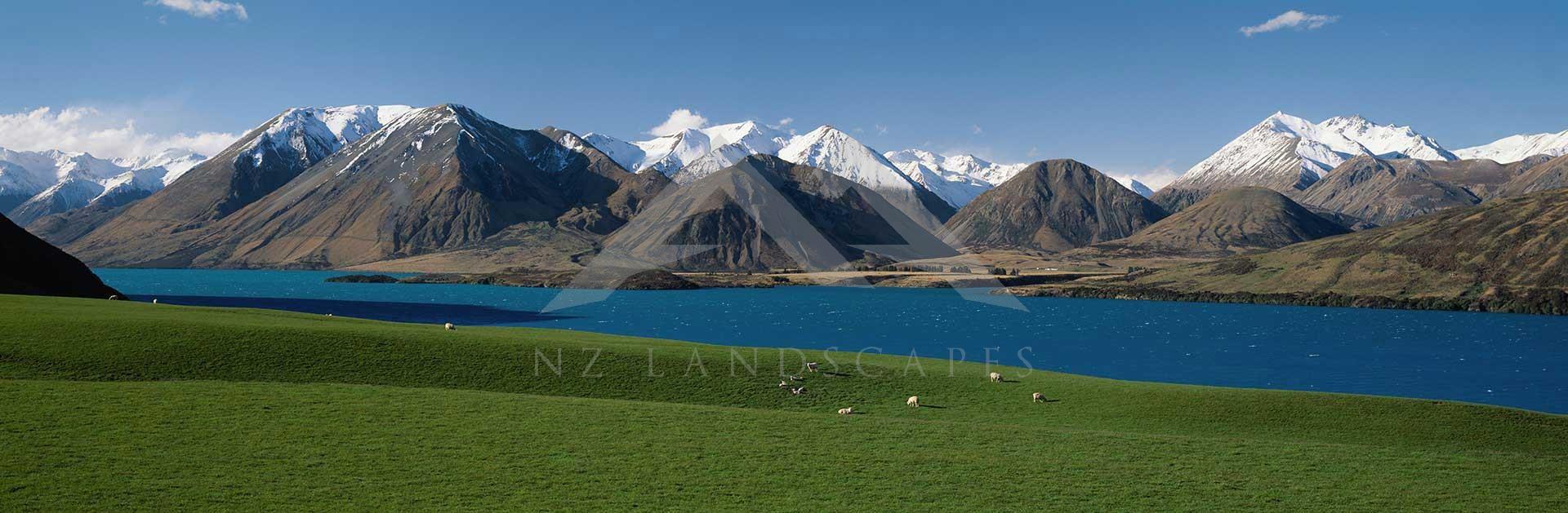
Lake Tekapo (Takapō)
Dark Sky Reserve
Lake Tekapo and the surrounding district were recognized as an International Dark Sky Reserve in 2012.
The reserve is 4367 square kilometres in size making it amongst the world's largest. The Dark Sky Reserve accreditation recognizes that the night skies are almost completely free of light pollution and ideal for star gazing.
Southern Alps Passes
About Southern Alps Passes, West Coast ...
There are four main access roads:- Buller Gorge from Nelson, Lewis Pass from Hanmer Springs, Arthur’s Pass from Christchurch and Haast Pass from Wanaka.
Buller Gorge
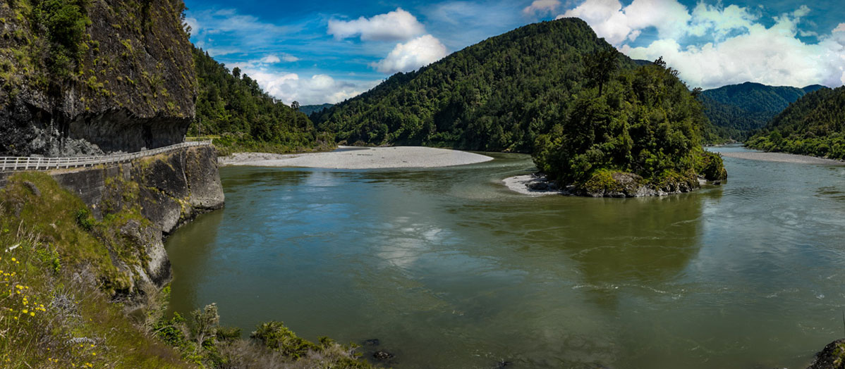
Buller Gorge to Reefton
The Buller Gorge is a gorge located in the northwest of the South Island of New Zealand. The Buller River flows through the deep canyon between Murchison and Westport. Land Information New Zealand lists two sections for the gorge, Upper Buller Gorge and Lower Buller Gorge. State Highway 6 runs alongside, but considerably above, the river through the gorge. The Stillwater - Westport Line railway also runs through the gorge.
New Zealand's longest swingbridge at 110 metres (360 ft) in length spans the Buller River 14 kilometres (9 mi) west of Murchison. That area also offers rides on a zip-line across the gorge as well as several short bush walks.
The gorge and river both take their name from Charles Buller, Member of Parliament in the United Kingdom of Great Britain and Ireland (UK) and director of the New Zealand Company, a UK-based company in the early 1800s with a royal charter supporting colonization efforts of New Zealand.
Lewis Pass

Lewis Pass (el. 907 m.) is a mountain pass in the South Island of New Zealand.
The northernmost of the three main passes across the Southern Alps, it is higher than the Haast Pass, and slightly lower than Arthur's Pass.
State Highway 7 traverses the pass on its route between north Canterbury and the West Coast; it passes through extensive unmodified beech forest.
The pass is the saddle between the valleys of the Maruia River to the northwest and the Lewis River to the southeast. The saddle is located close to the small spa of Maruia Springs.
The Lewis Pass is named after Henry Lewis who, together with Christopher Maling, was the first European to discover the pass, in April 1860 while working as a surveyor of the Nelson Provincial Survey Department.
Before this time the pass was used by the Ngāi Tahu Māori of Canterbury to transport Pounamu (greenstone) from the west coast.
The area around Lewis Pass is protected as a national reserve. There are a number of tramping routes in the Lewis Pass area, including the St James Walkway. The short Alpine Nature Walk loop walk around an alpine wetland and tarn can be accessed from a carpark near the saddle.
Arthur’s Pass

Arthur's Pass, previously called Camping Flat then Bealey Flats, and for some time officially Arthurs Pass, is a township in the Southern Alps of the South Island of New Zealand, located in the Selwyn district. It is a popular base for exploring Arthur's Pass National Park.
Arthur's Pass township is about 5 kilometres (3.1 mi) south of the mountain pass with the same name. Its elevation is 740 metres (2,430 ft) above sea level surrounded by beech forest. The Bealey River runs through the township. The town is located 153 kilometres (95 mi) from Christchurch a 2-hour drive on State Highway 73.
Haast Pass

Haast Pass & Lake Wanaka
The Haast Pass / Tioripatea is a mountain pass in the Southern Alps of the South Island of New Zealand. Māori used the pass in pre-European times.
The pass takes its name from Julius von Haast, a 19th-century explorer who also served as provincial geologist for the provincial government of Canterbury. Following the passage of the Ngāi Tahu Claims Settlement Act 1998, the name of the pass was officially altered to Haast Pass / Tioripatea.
It is one of the three passes where a road crosses over the Southern Alps – alongside the Lewis Pass and Arthur's Pass, although the Homer Tunnel passes under the Main Divide. The road through Haast Pass (State Highway 6) was converted from a rough track to a formed road in 1966 and received a complete chipseal surface by 1995.
The Haast Pass rises to a height of 562 metres (1,844 ft) above sea level at the saddle between the valleys of the Haast and Makarora Rivers. As such, it is the lowest of the passes traversing the Southern Alps. No settlements exist on the Haast Pass road between Haast and Makarora. The road passes through predominantly unmodified beech forest. The pass itself lies within the limits of Mount Aspiring National Park and forms part of the boundary between Otago and the West Coast.

Panoramic winter view from the summit of Hamilton Peak in the Craigieburn Range.
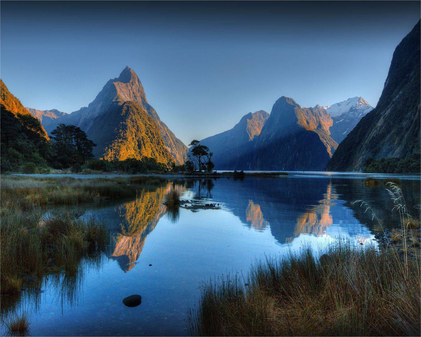

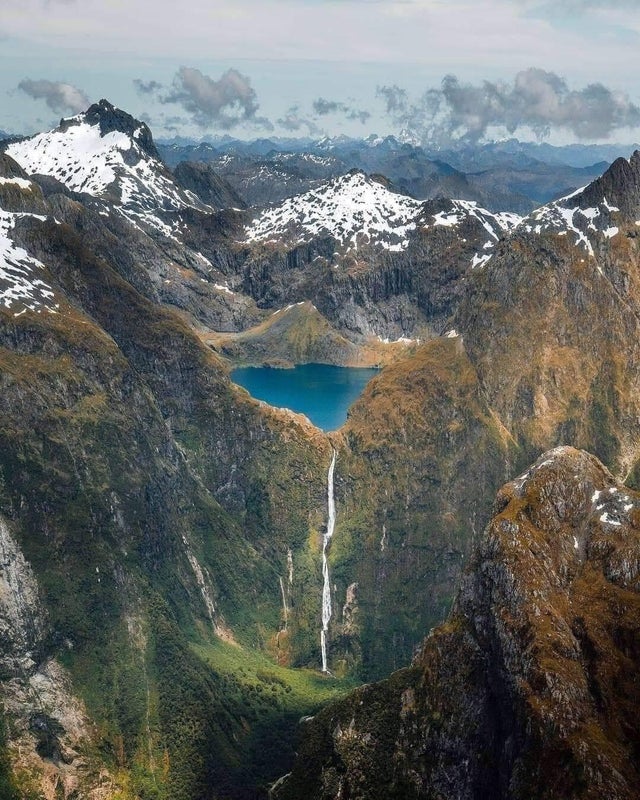
Sutherland Falls is a waterfall near Milford Sound in New Zealand's South Island. At 580 metres (1,904 feet) the falls were long believed to be the tallest waterfall in New Zealand. Terror Falls, in the Poseidon Valley (nearby), are 750m, and Browne Falls cascades 843 metres (2,766 feet) down a mountainside in Doubtful Sound, leading some to view that as the tallest.
The water falls from Lake Quill in three cascades: the upper is 229 m tall, the middle is 248 m, and the lower is 103 m tall. A vertical fall of 580 m is made over 480 m of horizontal distance, thus the mean grade of falls is approximately 56 degrees.
The base of Sutherland Falls is a 90 minutes (return) walk from Quintin Public Shelter on the Milford Track.
Sutherland Falls are visible in the background of the eagle scene in Peter Jackson’s fantasy film The Hobbit.
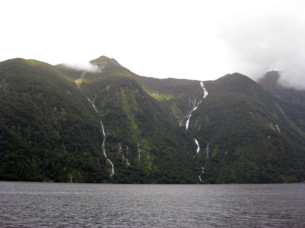
Browne Falls is a waterfall above Doubtful Sound, which is located in Fiordland National Park, New Zealand. In a temperate rain forest, the falls cascade down to the fiord near Hall Arm. Heights of 619 metres and 836 metres have been given for the falls. Their source is a tarn called Lake Browne (836 m above sea level) which when full, overflows down the side of the mountain face (similar to Sutherland's source).
The stream makes 836 m height difference over 1,130 m horizontal difference, thus the mean gradient of stream is 42 degrees. This comparatively low angle makes the falls less impressive.
The falls are one of the two candidates for the title of New Zealand's highest waterfall. The other is sourced from a tarn behind Elizabeth Island which is also in Fiordland.
The falls are named after pioneering aerial photographer, Victor Carlyle Browne, who discovered Lake Browne and the associated falls on one of his flights over Fiordland in the 1940s.
There are at least two other notable waterfalls falling to Doubtful Sound: Helena Falls and Lady Alice Falls.

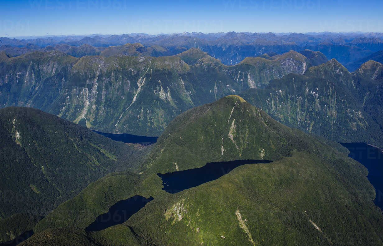
Aerial view of Lake Manapouriin Fiordland National Park in the South Island of New Zealand.
'Wonderful World' 카테고리의 다른 글
| 남부내륙철도 성주역(星州驛) 신설 최종 확정 (0) | 2022.02.18 |
|---|---|
| Fiordland National Park (0) | 2022.02.12 |
| Aoraki / Mount Cook National Park | 100% Pure New Zealand (0) | 2022.02.12 |
| 성주의 태실지 (0) | 2022.02.10 |
| 영월 청령포 장릉 [寧越 淸泠浦 莊陵] - 청령포에 흐르는 눈물 (0) | 2022.02.09 |